


Philanthropic Projects Manager
5 min read
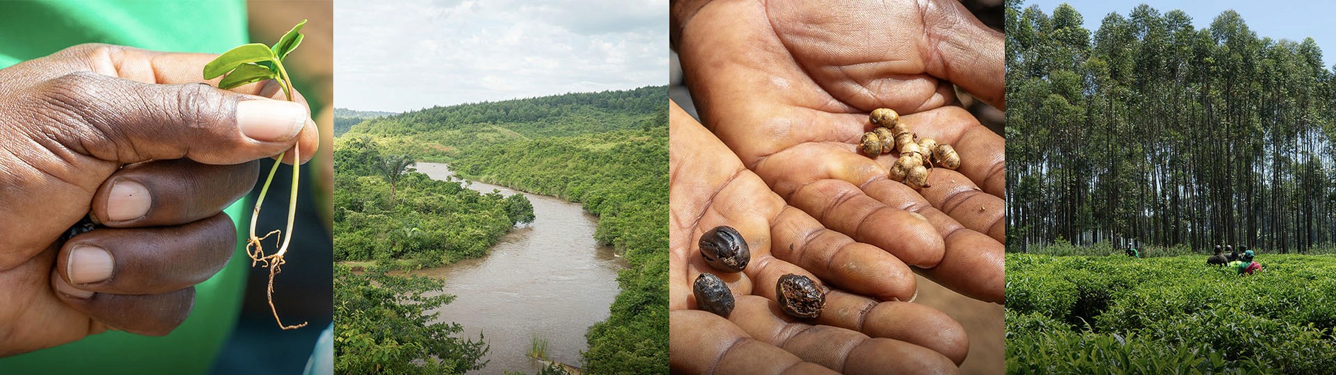
How we maximise the survival of planted trees
Planting trees is only the first step. Long-term impact depends on tree survival, ongoing monitoring, community involvement and effective management of risks such as drought, flooding and wildfires. In this guide, we explain how Ecologi and our partners monitor reforestation projects and track progress over time.
At Ecologi, maximising the impacts of our supported tree planting projects is central to our ethos of tackling climate change and restoring nature in a transparent, accountable, and impactful way.
From day one, we’ve taken extra care to find the right partners who implement projects with the needs of local people in mind to ensure that the right trees are planted in the right places to optimise positive outcomes for people and nature. For both communities and the environment to reap the abundant benefits from the trees that Ecologi’s community funds, monitoring their survival, growth, and protection, as well as the outcomes the trees facilitate, is our key priority.
In this blog, we’ll explain how Ecologi and our reforestation partners monitor project success. Get ready for a deep-dive into the satellite monitoring platform we use, and we’ll also walk you through the steps of how we handle hazards like flooding, droughts, and fires.
Preparing tree planting projects for long-term success
Arguably the most important work happens before anyone even plants a seed. Wherever trees are planted, it’s vital that the conditions are in place to ensure they reach their potential. Key to this is ensuring that people who live in and around the project area are invested in the success of the project, and that the project is designed with their needs in mind.
Extensive consultations with local communities help to build trust, and bring opportunities for people with local and Indigenous knowledge to help shape the project. Engaging in an open way with local groups allows our partners to identify potential pitfalls that might affect the project, and address these concerns before they cause problems.
This phase of the project also enables our partners to deliver educational sessions. For example, our partners who deliver agroforestry projects spend a lot of time providing environmental education to farmers who will receive trees and seeds through the project. This work helps to maximise tree survival rates, but also helps farmers get the most out of their land in a sustainable way.
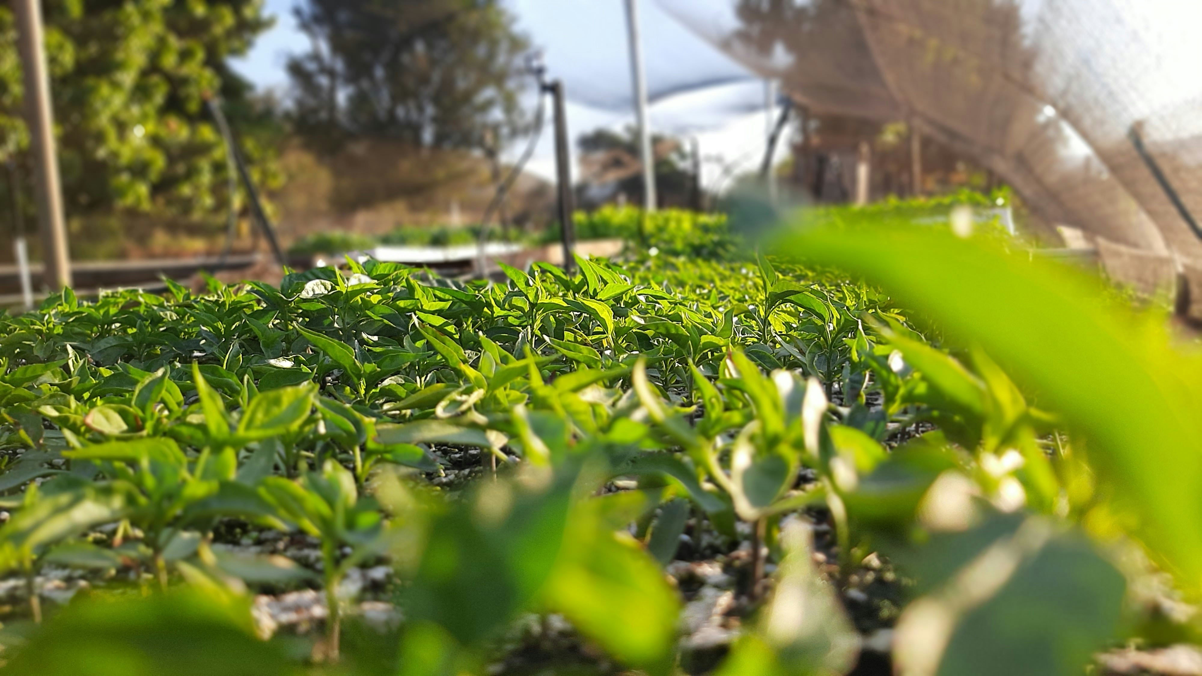
Just as the local community must be engaged for a project to be a success, the land also must be prepared to provide the best habitat for the trees to be planted in. This might involve clearing invasive vegetation, or digging holes to hold water for newly-planted trees.
Both these phases of tree planting projects are things we consider when assessing project quality. High quality projects pay attention to these phases, because they have a significant impact on the outcomes that tree planting can produce.
Assessing project quality
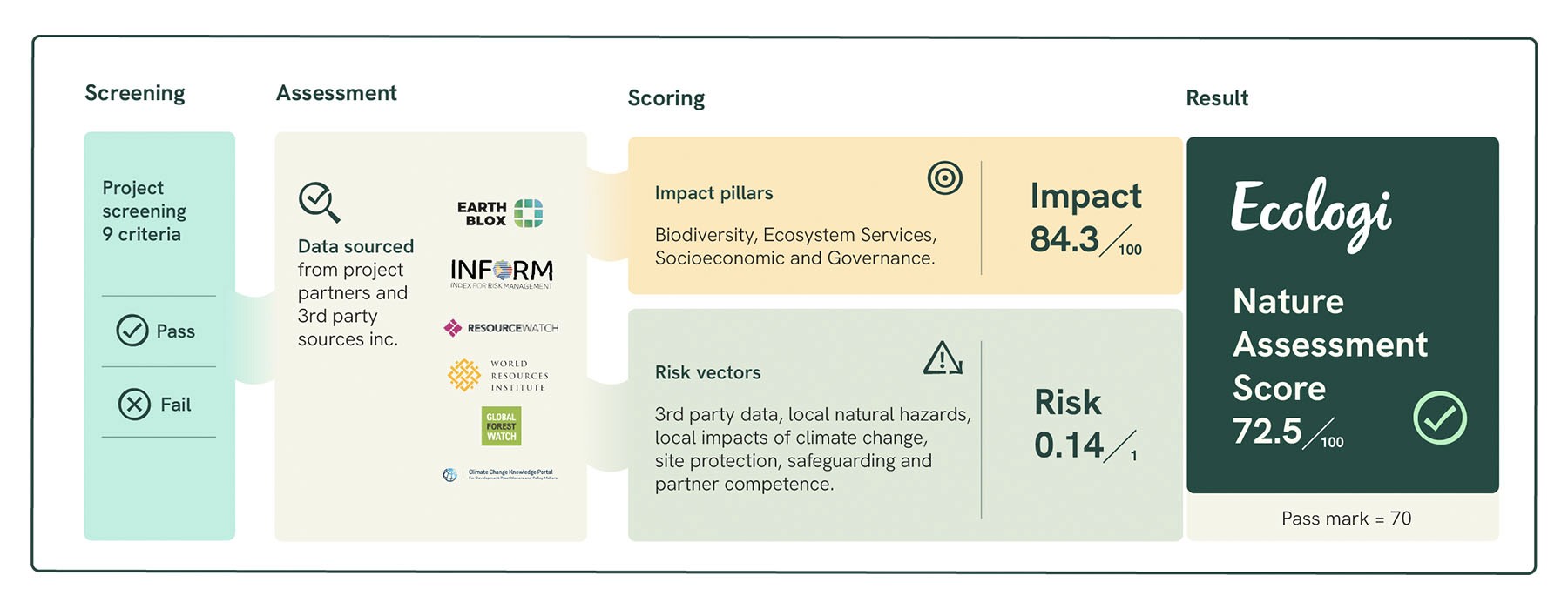
To ensure we are only committing to the most robust initiatives, we recently developed the Nature Projects Assessment Framework (NPAF), a standardised, science-based benchmark designed to evaluate project durability before a single penny is committed. Moving beyond simple headline metrics like "hectares restored," the NPAF dives deep into four core pillars of integrity: Biodiversity, Socioeconomic Impacts, Ecosystem Services, and Governance.
We also scrutinise six critical risk dimensions, ranging from local climate change impacts and natural hazards to partner competence and safeguarding, to ensure we aren't just planting trees, but protecting the people and ecosystems around them. By weighting these impacts against potential risks, we calculate a final Nature Assessment Score. As we show in the diagram below, only projects that achieve a minimum score of 70 out of 100 make it into the Ecologi portfolio. This high threshold ensures that every project our community funds is built on a foundation of sound design, ethical practice, and genuine, long-term impact.
Monitoring tree survival and project impact
Once trees are planted, it’s important that we stay informed about the projects we’re supporting in order to track their progress and success. Our Impact team receives regular updates from all our reforestation partners and projects. Most partners send us updates every three months, and in addition to these more formal reports, we’re also in regular communication with our partners, who update us with news and stories from the field as soon as they become available. This regular and open communication ensures we are always informed of the latest developments on the ground.
Our reforestation partners use a variety of monitoring methods, as different types of tree planting projects require different monitoring approaches. However, one metric that is universally important to all our partners, and the Ecologi team, is the survival rate of planted trees.
We work with partners who give the trees we fund the best chance of survival, but it's virtually impossible to ensure that all planted trees survive. The first year is the most critical for a tree's survival. It takes time for trees to establish themselves, growing the roots they need to support themselves and provide them with the nutrients and water they need to grow. It is within this first critical year that trees are also most vulnerable to damage, including from grazing animals or adverse weather conditions.
Our partner organisations put in place the conditions to maximise tree survival rates. The reason for maximising tree survival rates is to generate the best outcomes for people and nature.
Besides the tree survival rate, there are other important metrics that our partners report on, such as the number of livelihoods each project has supported. Some of our partners pay local people to grow seedlings for planting, generating a sustainable income for those people, as well as fostering ownership of the project among the local community. For other projects, local people volunteer to help plant trees in return for goods and services they need in their community, such as irrigation systems or healthcare facilities. For such projects, the number of livelihoods supported can represent entire communities. And for the agroforestry projects Ecologi supports, farmers are supported to increase their income in a sustainable way through crop diversification and sustainable agricultural methods. This has a positive impact on whole families.
Monitoring reforestation projects at scale with Earth Blox
Ecologi has developed a systematic, internal, and on-demand monitoring system for reforestation projects implemented by our local partners. The system aims to go beyond the ground monitoring conducted by partners by capturing project performance data at scale, and at a higher frequency than is possible with on-the-ground monitoring.
Edinburgh based geospatial company Earth Blox provides an interactive, customisable modelling tool to monitor nature-based projects through the use of satellite imagery. In collaboration with our reforestation partners, we upload spatial files to Earth Blox to monitor two key elements of project performance: vegetation growth and vegetation change.
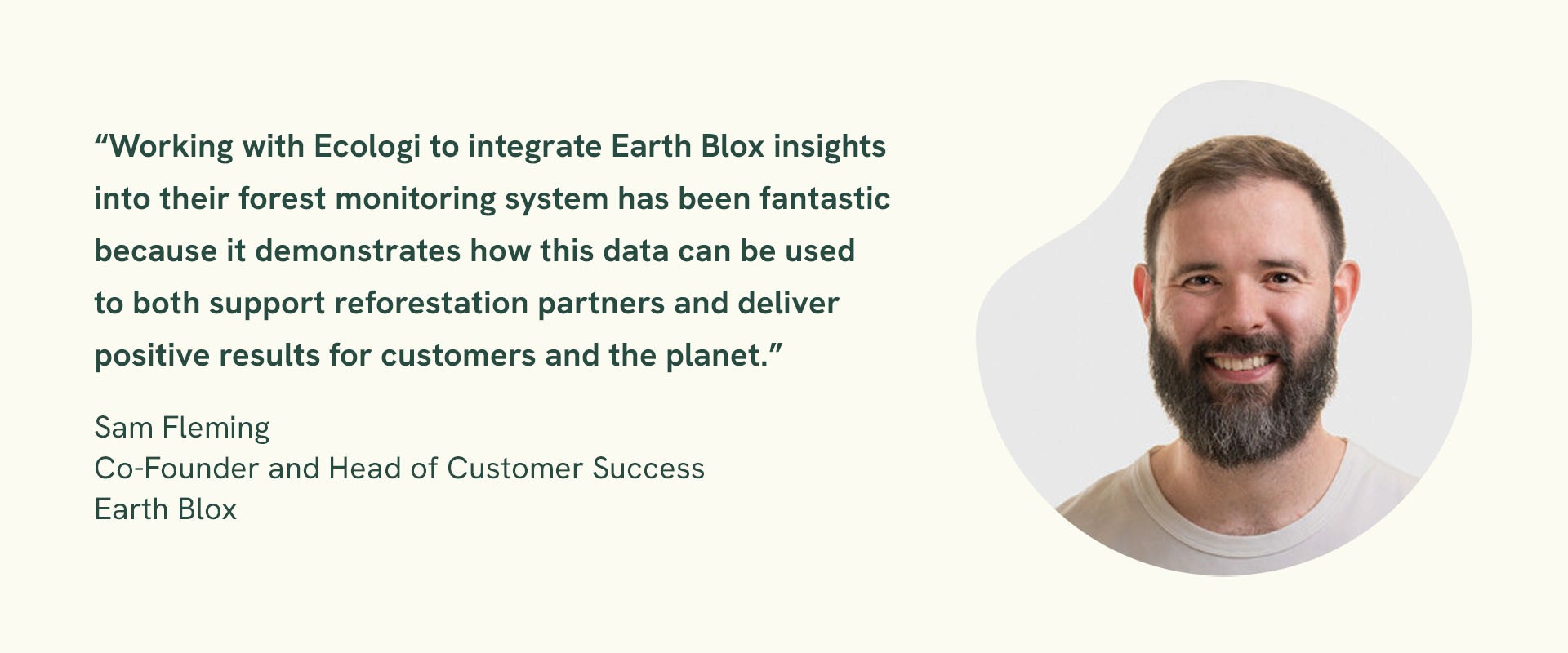
Sam Fleming, Co-Founder and Head of Customer Success at Earth Blox says:
“Satellite data is like having eyes in the sky. The transparency it provides is crucial for building trust with those investing in nature restoration.”
Our monitoring processes use a combination of typical vegetation indices (VIs) and proprietary analyses based on scientific literature. We use the latest satellite imagery, such as Sentinel-2 and PALSAR/PALSAR-2, along with secondary datasets such as World Resources Institute (WRI) land cover and ERA5. We monitor tree cover, normalised difference vegetation index (NDVI), enhanced vegetation index (EVI), and soil adjusted vegetation index (SAVI), as well as forest biomass for growth. We also monitor the presence of natural hazards, focusing on fire and drought.
We monitor the growth of the trees every six months, during the dry season (December - February) and the wet season (May - August). This allows us to see their progress during the main growing seasons.
However, hazards can occur at any time, and can have a significant impact on newly reforested plants. We monitor hazards every quarter to ensure the safety and health of the trees. In rare cases where degradation is detected, we contact our partners to request more information, understand how we can assist, get assurances that any trees lost have been or will be replanted, and mitigation measures are implemented. Thanks to the power of Earth Blox, we can standardise our process and improve reproducibility across sites and time periods.
While monitoring data will be kept internally, Ecologi will openly share project information updates with our community, including reforestation progress and significant events that could alter the planned course of the projects.
Managing droughts, floods and wildfires in reforestation projects
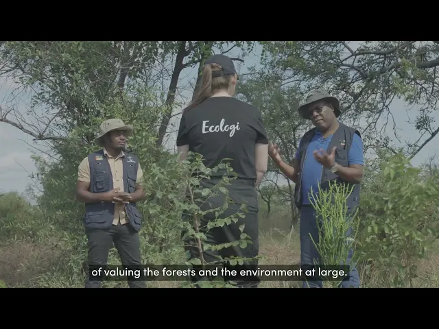
When working with nature, we must expect the unexpected. We’ve built strong relationships with all our reforestation partners, which is especially important when things go wrong. There will be times when things don't go according to plan, and when problems arise it’s vital we work together to find solutions.
Natural hazards, such as flooding in Uganda, droughts in the UK, and forest fires in Mozambique, can have a significant impact on reforestation projects. Working with experienced and conscientious partners helps to mitigate the risk of natural hazards. We also conduct detailed risk assessments that consider the threat posed by natural hazards and the mitigating actions taken by our partners before we fund any project.
Our remote monitoring system can detect threats such as forest fires from thousands of miles away. When reviewing a site we support in Mozambique, we noticed there had been some higher temperatures recorded during July and August 2022. This indicated that there had been fires within the site.
We contacted our implementing partner to ask whether the fires had damaged the trees. They informed us they had taken several measures to protect the trees, such as planting fire-resistant species in areas prone to fires, and creating firebreaks by removing grass from around the trees and laying it around the edge of planting areas.
In May 2023, we were invited by the implementing partner to visit the site to see first-hand the success of these interventions. We were very impressed to see that the trees on the site were thriving, despite fires moving through the project area just a few months previously. This transparency with our partners is essential to ensure that we are using our community's funding in the best way possible.
Despite our best efforts, some risks cannot be fully mitigated. Therefore, it is critical that we work closely with our partners to help projects recover from setbacks. For example, we helped Protect Earth replant trees in a project in Radstock, England, that were lost in the 2022 drought. We also provided additional financial support to Trees for the Future to plant more trees to stabilise soil around Forest Gardens that floods had damaged in the summer of 2022.
Watch our video to learn more.
A commitment far beyond planting day
Planting a tree is a single moment, but growing a forest is a decades-long commitment. As we have seen, the real work doesn't end when a seed hits the soil; it’s a continuous cycle of monitoring, protecting, and adapting to an ever-changing climate.
By combining the scientific rigour of our Nature Projects Assessment Framework (NPAF) with the "eyes in the sky" provided by Earth Blox, we are able to move beyond promises and provide genuine, data-driven transparency. Ecologi and our partners can work together to address some of the challenges posed by climate change and natural hazards. Together, we can deliver projects that help to limit global warming and protect communities from the impacts of climate change.
Through this blend of high-tech innovation and deep-rooted local partnership, we aren't just planting trees, we are restoring ecosystems that will thrive for generations to come.
Fund high-quality tree planting that lasts with Ecologi
At Ecologi, we help businesses support high-quality nature projects with a stronger focus on outcomes. Our team can help you build a credible nature investment strategy, grounded in science and aligned to your wider climate goals.
Want to explore the right approach for your business?
Glossary of terms
Enhanced vegetation index (EVI)
The Enhanced Vegetation Index (EVI) is an advanced vegetation index created with high sensitivity to biomass, atmospheric background, and soil condition. The value of EVI ranges from 0 to 1. A value closer to 1 represents healthy vegetation and a value closer to 0 represents unhealthy vegetation.
ERA5
ERA5 is the fifth generation European Centre for Medium-Range Weather Forecasts atmospheric reanalysis of the global climate covering the period from January 1940 to present. ERA5 is produced by the Copernicus Climate Change Service. It provides hourly estimates of a large number of atmospheric, land and oceanic climate variables.
GIS model
A Geographic Information System (GIS) is a tool that can process, display, and integrate different data sources including maps, digital elevation models (DEMs), GPS (global positioning system) data, images, and tables. A GIS data model enables a computer to represent real geographical elements as graphical elements.
Normalised difference vegetation index (NDVI)
NDVI is used to quantify vegetation greenness and is useful in understanding vegetation density and assessing changes in plant health. NDVI always ranges from -1 to +1. NDVI values close to +1, shows a high possibility of dense green leaves.
PALSAR/PALSAR-2
The PALSAR-2 aboard the satellite ALOS-2 is a Synthetic Aperture Radar (SAR), which emits microwaves and receives the reflection from the ground to acquire information. It is an all-weather observing capability suitable for monitoring disasters rapidly.
Sentinel-2
SENTINEL-2 is a European wide-swath, high-resolution, multi-spectral imaging mission. The full mission specification of the twin satellites flying in the same orbit but phased at 180°, is designed to give a high revisit frequency of 5 days at the Equator.
Soil adjusted vegetation index (SAVI)
The Soil-Adjusted Vegetation Index (SAVI) is a vegetation index that attempts to minimise soil brightness influences using a soil-brightness correction factor. This is often used in arid regions where vegetative cover is low.
World Resources Institute (WRI) land cover
WRI is a global nonprofit organisation that works with leaders in government, business and civil society to research, design, and carry out practical solutions that simultaneously improve people’s lives and ensure nature can thrive. WRI land cover (Dynamic World) is a 10-metre resolution near real time global land use land cover dataset in Google Earth Engine.